

Ich habe mal einige Bilder zum National Scenic Byway 12, Utah's First All-American Road, zusammengestellt. Sicherlich habe ich nicht alles Sehenswerte und Interessante an der Road geknipst; wer auch ein paar Bilder beitragen kann und will, sollte dies tun. ![]()
Eine Übersichtskarte mit weiteren Informationen gibt es hier.
Gestartet wird an der Westseite der Route 12 an der Kreuzung zur #89.
[Blockierte Grafik: http://foto.arcor-online.net/p…7988/6561333864663632.jpg]
Und die Fahrt geht gen Osten.
[Blockierte Grafik: http://foto.arcor-online.net/p…7988/3232393839373665.jpg]
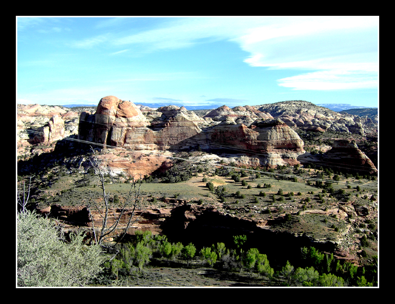
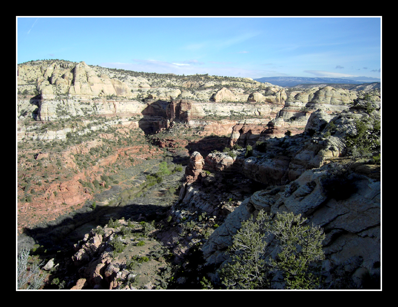
Erster sehenswerter Punkt von Osten auf der #12 ist der Red Canyon. Die roten Felsformationen liefern schon mal einen Vorgeschmack auf den Bryce Canyon einige Meilen weiter.
[Blockierte Grafik: http://foto.arcor-online.net/p…7988/3333316632643166.jpg]
[Blockierte Grafik: http://foto.arcor-online.net/p…7988/6630306236646334.jpg]
Dieser Bogen über die Straße hat wohl irgendwann mal aufgegeben.
[Blockierte Grafik: http://foto.arcor-online.net/p…7988/3639326138326137.jpg]
[Blockierte Grafik: http://foto.arcor-online.net/p…7988/3932383132363738.jpg]
[Blockierte Grafik: http://foto.arcor-online.net/p…7988/3065663737343336.jpg]
[Blockierte Grafik: http://foto.arcor-online.net/p…7988/3561656662303335.jpg]
"Sculpture Of The Land" am Beginn des Birdseye Trail.
[Blockierte Grafik: http://foto.arcor-online.net/p…7988/3362363061326261.jpg]
[Blockierte Grafik: http://foto.arcor-online.net/p…7988/3563616563623136.jpg]
[Blockierte Grafik: http://foto.arcor-online.net/p…7988/3539623637656430.jpg]
[Blockierte Grafik: http://foto.arcor-online.net/p…7988/3038393135343366.jpg]
Den kurzen Pink Ledges Trail kann man locker mal gehen.
[Blockierte Grafik: http://foto.arcor-online.net/p…7988/3135333561633766.jpg]
[Blockierte Grafik: http://foto.arcor-online.net/p…7988/3533323264393439.jpg]
[Blockierte Grafik: http://foto.arcor-online.net/p…7988/3366376335393436.jpg]
Am Red Canyon Visitor Center kann man sich Infos holen; wenn es geschlossen ist, eben über die Tafeln bzw. Karten.
[Blockierte Grafik: http://foto.arcor-online.net/p…7988/3235363133633765.jpg]
[Blockierte Grafik: http://foto.arcor-online.net/p…7988/6465303632343439.jpg]
[Blockierte Grafik: http://foto.arcor-online.net/p…7988/6330336566346439.jpg]
[Blockierte Grafik: http://foto.arcor-online.net/p…7988/6634306438366232.jpg]
[Blockierte Grafik: http://foto.arcor-online.net/p…7988/3362323338373735.jpg]
Weiter auf der #12 gen Osten.
[Blockierte Grafik: http://foto.arcor-online.net/p…7988/6230353564643733.jpg]
[Blockierte Grafik: http://foto.arcor-online.net/p…7988/3762356461353537.jpg]
[Blockierte Grafik: http://foto.arcor-online.net/p…7988/3736373134333463.jpg]
[Blockierte Grafik: http://foto.arcor-online.net/p…7988/6234643563623434.jpg]
[Blockierte Grafik: http://foto.arcor-online.net/p…7988/6537393237306161.jpg]
[Blockierte Grafik: http://foto.arcor-online.net/p…7988/3939623837396237.jpg]
Die beiden Durchfahrten durch zwei künstlich geschaffene Felsbogen sind ganz lustig
[Blockierte Grafik: http://foto.arcor-online.net/p…7988/6336653032336136.jpg]
[Blockierte Grafik: http://foto.arcor-online.net/p…7988/6336393964346263.jpg]
[Blockierte Grafik: http://foto.arcor-online.net/p…7988/3936633935396138.jpg]
[Blockierte Grafik: http://foto.arcor-online.net/p…7988/6636336133363533.jpg]
[Blockierte Grafik: http://foto.arcor-online.net/p…7988/6662326338333931.jpg]
[Blockierte Grafik: http://foto.arcor-online.net/p…7988/6239373363643630.jpg]
[Blockierte Grafik: http://foto.arcor-online.net/p…7988/3037633263646530.jpg]
"Popular Through The Ages" – im Laufe der Jahre fanden nicht nur Jäger und Rancher gefallen an dem Red Canyon, sondern auch Butch Cassidy and The Sundance Kid.
[Blockierte Grafik: http://foto.arcor-online.net/p…7988/3135646531313030.jpg]
[Blockierte Grafik: http://foto.arcor-online.net/p…7988/3735346465333237.jpg]
[Blockierte Grafik: http://foto.arcor-online.net/p…7988/3731663661666265.jpg]
Die letzten Ausläufer des Red Canyon auf der Fahrt zum Bryce Canyon.
[Blockierte Grafik: http://foto.arcor-online.net/p…7988/3438393136666537.jpg]
[Blockierte Grafik: http://foto.arcor-online.net/p…7988/3263616632353335.jpg]
[Blockierte Grafik: http://foto.arcor-online.net/p…7988/3438646333306238.jpg]
Bei einem kleinen Museum nahe der Straße zum Bryce werden historische bzw. alte Fahrzeuge ausgestellt und auch was zum Bergbau in der Region. In der Nebensaison ist es leider meist geschlossen.
[Blockierte Grafik: http://foto.arcor-online.net/p…7988/6135613238323232.jpg]
[Blockierte Grafik: http://foto.arcor-online.net/p…7988/6263633166616162.jpg]
[Blockierte Grafik: http://foto.arcor-online.net/p…7988/3434633731373030.jpg]
[Blockierte Grafik: http://foto.arcor-online.net/p…7988/6630646133636661.jpg]
[Blockierte Grafik: http://foto.arcor-online.net/p…7988/6232303637363136.jpg]
Nähe Bryce Canyon Airport
[Blockierte Grafik: http://foto.arcor-online.net/p…7988/6135613238323232.jpg]
[Blockierte Grafik: http://foto.arcor-online.net/p…7988/3565313233313936.jpg]
[Blockierte Grafik: http://foto.arcor-online.net/p…7988/3734333433653830.jpg]
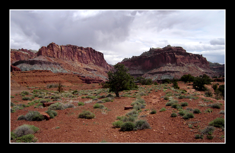
"The Paunsaugunt Plateau" – die "Heimat des Bibers" wurde dadurch geformt, dass sich der eine Erdkrustenblock anhob und der andere senkte.
[Blockierte Grafik: http://foto.arcor-online.net/p…7988/6538303265653332.jpg]
[Blockierte Grafik: http://foto.arcor-online.net/p…7988/3630636433363136.jpg]
An dieser Stelle trifft die Zufahrtsstrasse zum Bryce Canyon NP auf die #12.
[Blockierte Grafik: http://foto.arcor-online.net/p…7988/3436613238623736.jpg]
....to be continued...